
Algonquin ZIP Coverage at a Glance
Census place geography shows five ZIP Code Tabulation Areas, or ZCTAs, intersecting Algonquin. A ZCTA is a statistical shape built for census data. It is not an official list of delivery addresses, so every row below needs a complete-address check with USPS.
| ZIP Code | Areas Covered | Post Office | Notes |
|---|---|---|---|
| 60102 | Algonquin and nearby postal area | Algonquin is commonly used | Village and ZIP lines differ |
| 60013 | Cary-area intersection | Cary-area convention | Overlap does not place every address in Algonquin |
| 60118 | Regional and Elgin-area intersection | USPS label must be checked | ZCTA name is not municipal proof |
| 60142 | Regional and Huntley-area intersection | USPS label must be checked | Confirm with parcel situs |
| 60156 | Lake in the Hills-area intersection | Lake in the Hills convention | Postal, village, and county lines diverge |
Research found no authoritative static street-to-ZIP crosswalk for Algonquin. The table measures intersection with the incorporated place, not delivery coverage for every house. The common 60102 label is therefore a starting point, not a universal answer.
Verify Algonquin ZIP Codes with USPS
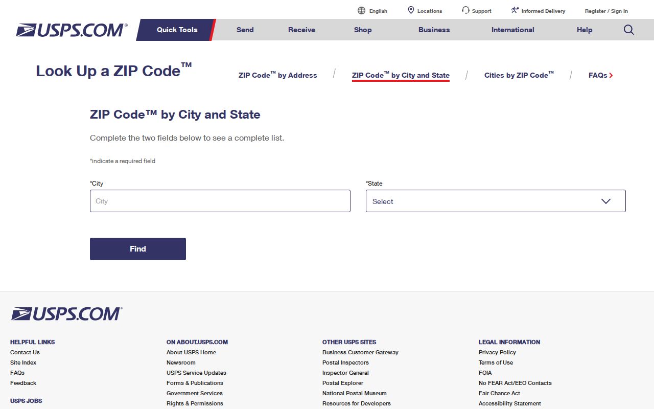
The USPS ZIP Code Lookup is the street-level authority. Enter the house number and street, along with the city and Illinois. Preserve the preferred city and delivery ZIP returned by the service. A city-only search may return several codes and cannot resolve whether a specific house is inside village limits.
| USPS control | Type | When required | Use |
|---|---|---|---|
| Search mode | Tab or selector | Always | Choose complete address or city/state |
| Street address | Text | Address mode | House, street, and unit where relevant |
| City | Text | City route | Enter Algonquin or test the returned postal city |
| State | Select | City route | Illinois |
| ZIP | Text | Optional in city route | Five digits or ZIP+4 when known |
The live response is the evidence for postal delivery. Save it separately from county, village, township, and ZCTA labels. The inspected capture did not produce a stable Algonquin street result, so no sample house assignment should be inferred from the census overlap.
The USPS lookup screen shows the official starting point for an Algonquin delivery-code check.
Algonquin 60102 Is Not Universal
Most people associate Algonquin with 60102, yet the census place intersects four other ZCTAs. A fringe address may use a Cary, Lake in the Hills, Elgin-area, or Huntley-area postal convention while still touching Algonquin geography. The reverse can also occur: an Algonquin mailing label does not by itself establish incorporation.
This is a useful local correction to a common shortcut. ZIP codes route mail. Village borders determine municipal jurisdiction. Counties determine which recorder, assessor, court, and election office serves the address. A ZIP code directory should preserve all three rather than force them into one field.
Note: Treat 60102 as a common search value, then verify the exact house through USPS and the parcel's county GIS.
Find Algonquin Residents by ZIP
The county portals inspected for Algonquin do not offer a verified, complete ZIP filter. Work from the complete address instead. A ZIP first narrows the postal area; the parcel card and GIS then resolve the county, PIN, subdivision, and physical site.
- Collect the full house number, street, direction, suffix, and unit. Do not begin with “Algonquin” alone.
- Run USPS lookup and record the preferred city, five-digit code, and ZIP+4 if returned.
- Search both county assessor systems by address until the site resolves. Compare situs and owner mailing fields.
- Open the PIN in McHenry Athena or KaneGIS4. Record the county, subdivision, and relevant district layers.
- Use the recorder or historical directories only after the parcel and address form are stable.
Once the ZIP search has narrowed the address, the Algonquin street directory gives the full street-level parcel and deed workflow. That handoff avoids treating a broad ZIP as a list of current occupants.
Algonquin Portals Use Address Fields
McHenry DevNet accepts PIN, owner name, and site address. Its inspected description did not reveal a ZIP field. Kane DevNet separates house number, street name, street type, and city, and adds district, subdivision, sale, and tax-year controls. No ZIP criterion was visible there either.
McHenry Athena has parcel, subdivision, address, owner, and sales tabs. KaneGIS4 has parcel, address, subdivision, PinInfo, and buffer tools. These systems resolve property geography well, but neither documented a direct ZIP-wide resident search. Use the USPS result as a postal fact and the PIN as the property join key.
| Portal | ZIP field captured? | Best substitute | Result type |
|---|---|---|---|
| McHenry DevNet | No | PIN, owner, site address | Tax and parcel card |
| Kane DevNet | No | House, street, city, subdivision | Parcel results |
| McHenry Athena | Not documented | Address or map search | Parcel geography |
| KaneGIS4 | Not documented | Address, parcel, subdivision | Map and PinInfo |
| Kane voter search | No | Name, house, street | Election status and districts |
Do not label any of these tools as a ZIP filter. Their address and map controls are useful only after the postal code has been checked elsewhere.
ZIP Cannot Pick Algonquin County
Algonquin's McHenry-Kane split is more important to records than its postal code. The county line selects the assessor, recorder, circuit court, and election custodian. USPS boundaries serve delivery needs and can cross those government lines.
When a parcel card shows a mailing city, state, and ZIP different from the site, copy both. The mailing field identifies where a tax bill goes. It does not change the parcel's physical county or prove that the owner lives there. The county GIS and PIN are better routing evidence.
For Kane-side election research, the public form uses last name, house number, or street name and returns registration status, precinct, polling place, districts, and sample ballot. McHenry points users to the state lookup and Clerk contact. Neither route creates a public ZIP-wide resident roll.
Older Algonquin Addresses Need More
An old directory or deed may identify Algonquin by township, post office, or an earlier local name rather than a modern delivery code. Local histories preserve Cornish's Ferry and Osceola as search terms. Fox River, Algonquin Township, and Cary/Algonquin can also appear as geographic clues.
No official Algonquin street-renumbering or ZIP realignment schedule was located. For an older address, compare the recorded plat, the 1929 Sanborn map, local directories, county GIS street labels, and the current USPS result. A subdivision name can remain useful after a street number changes.
That history explains why a person may appear in a county or township section without a modern ZIP code directory entry. Preserve the exact old wording before translating it into today's address.
Algonquin ZIP Data Is Not a Roll
Census QuickFacts reports Algonquin village at 29,700 residents in 2020, a 2025 estimate of 30,824, 12.30 square miles of land, and 10,968 households for 2020 through 2024. These are village measures, not totals for 60102 or any other ZIP.
The distinction matters. ZCTAs are made for statistical reporting and may cross the incorporated boundary. USPS codes route delivery. Neither source publishes a list of residents. Use census numbers for scale and geographic context, never as proof that a named person occupies an address.
Census QuickFacts for Algonquin is the proper source for village totals, while the Census place profile supports the ZCTA intersection.
Store Algonquin Geography Separately
A clean address record needs more than one location box. Separating the fields makes ZIP searches easier to audit and prevents one boundary system from standing in for another.
- USPS preferred city and delivery ZIP from a complete-address result
- Physical or situs address from the parcel card
- Owner mailing address from the tax account
- McHenry or Kane county and the parcel PIN
- Village, township, subdivision, and census ZCTA labels
If two fields conflict, do not overwrite one. A different mailing ZIP may be fully valid, while the situs and county still determine the public-record route. Keep the source and date beside each value.
Algonquin ZIP and Village Limits
Postal delivery, census geography, county jurisdiction, and the incorporated village boundary are four different systems. An address may carry an Algonquin postal label outside the village, or a neighboring postal label at a site that touches Algonquin geography. Use USPS for delivery, county GIS for parcel location, and municipal maps for village status.
- ZIP and ZIP+4
- A five-digit delivery area and an added four-digit segment that narrows delivery to a smaller group of addresses.
- PO-box ZIP
- A code used for post-office boxes rather than ordinary street delivery. No Algonquin-only example was verified in the research.
- Unique ZIP
- A code assigned to one high-volume organization. No Algonquin unique code was verified.
- Carrier route
- A delivery sequence within a ZIP. It is a postal route, not a village or county border.
Boundary check. Never use an Algonquin ZIP code alone to select a recorder, assessor, court, or election office. Confirm the county and PIN first.
The Algonquin ZIP code directory is most accurate when it admits the gaps. No static USPS street crosswalk, verified portal ZIP filter, or official ZIP realignment schedule was found. A current complete-address lookup is therefore the sound final check.